
April was dry to the bone, while the first three weeks of May were “meh.”
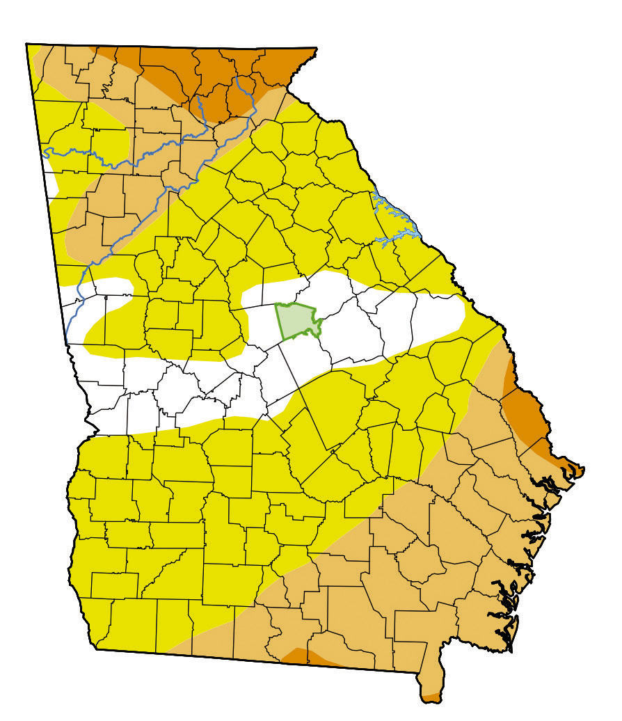
Fortunately, however, the past five weeks have brought some much-needed rain to Baldwin County, which is represented in the most recent United States Drought Monitor Map.
On the map, Baldwin County is now shaded white, which is the “none” category. As recently as mid-May, Baldwin County ws in the D2 “severe drought” category.
The United States Drought Monitor map, which is a collaboration between different federal government agencies and different academic institutions, has four levels of drought – DO through D4.
The Cooperative Extension weather station in Tennille, which is the most proximate to Milledgeville, recorded 21 rainy days between May 22 through June 29. Compare this to March 17 through April 27, when there were a mere three rainy days.